


History of Venezuela
Geography of Venezuela
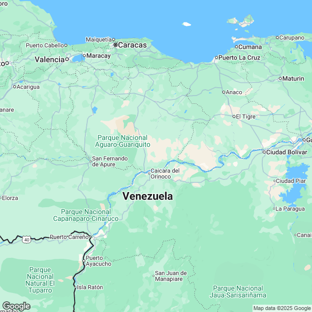
Venezuela is the 33rd largest country in the world with its mainland located within the South American plate. The country covers a total area of 912, 050 square kilometers where 30, 00 square kilometers of the total land is under water and the rest is a dry land. The state has a coastline with several islands in the Caribbean Sea and the south Atlantic sea which gives the country a roughly triangular shape. The northeast, northern and the southeast regions of the country is dominated with lowlands, mountains and highlands respectively while wide plains cover the coastal regions. The Caribbean Sea at zero meters below the sea level is the lowest point in the country, while the highest point is in the Pico Bolivar at 5, 007 meters above the sea level.Climate of Venezuela
Venezuela lies within the tropical climate along the equator. The lowlands are humid and the northwest semi arid regions receive low rainfall, while the highlands in the southern area receive higher amounts of rainfall. Low precipitation levels are experienced during the hot humid months from November to April and the cold dry months from Augusts to October. The winters have a temperate tropical climate, while the other seasons are usually in polar climates.Natural Resources in Venezuela
Venezuela is the world's fifth country in terms of oil reserves. The natural gas and hydro power generation within Venezuela are the energy source substitutes of the oil. Other mineral deposits of economical importance in Venezuela include diamond, gold and iron ores.Tourist Attraction in Venezuela
The country's place within the tropical climate exposes it to a great diversity noted in its landmarks which attract many tourists from all over the world. The Morrocoy national park with beautiful sand beaches and many cays and islets; the yellow and orange shades of the colorful sand dunes in the Medanos de Coro park; the Mochima national park crowded by the snorkelers and divers where dolphins prevail and the table top mount Roraima where Brazil and Guyana join with Venezuela and the center of the Canaima national park, are among the major tourists' attraction sites available in Venezuela. Other special tourists' magnetic landmarks within the territory include the highest and longest Merida cable car in the world, the Caribbean beaches of Choroni and the Archipelago park of Los Roques. The top big cities within Venezuela include:- Caracas
- Maracaibo
- Barquisimeto
- Ciudad Guyana
- Maturin
- Maracay
Famous Hotels in Venezuela
The famous hotels of Venezuela are- Posada Casa Sol
- Posada Don Elicio
- Hotel boutique Isabel La Catolica
- Cayena Caracas Hotel
- Posada El Solar de la Luma
- Posada el Encanto
Venezuela Culture and Cuisine
The melting pot of the Venezuelan culture has the Spanish; indigenous and African cultures rotating within it. Venezuela has the freedom of religion but the Roman Catholic is the most popular religion. The main dishes served in Venezuela include the maize pancakes with the arepa traditional food being the national bread and mandoca corn meal enjoyed when hot. Ponche crema, chichi and milkshakes are the preferred drinks in Venezuela. The most consumed fruits being mangoes and passion fruits.International Airports in Venezuela
- Simon Bol�var airport
- Ciudad Guayana airport
- Caicara de oro airport
- Gen J A Anzo�tegui airport
- Ciudad Bol�var airport
- Vare Maria airport
- Oro negro airport
Posted By : All Places Map Last Updated: August 08, 2015
Flag of Venezuela

Facts about Venezuela | |
|---|---|
| Country | Venezuela |
| Continent | South America |
| Capital | Caracas |
| Government | Federal |
| Independence Day | July 5, 1811 |
| Climate | Tropical |
| Area | 916,445 sq km |
| Currency | Bol |
| Dialling Code | 58 |
| Neighbours | Brazil, Colombia, Guyana |